Riverscapes Studio for QGIS
Data Organization
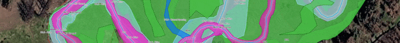
QRiS provides a flexible, extensible structure for your spatial layers, together with consistent symbology to streamline your data capture, monitoring and analysis.
Details...Your Project Through Time
Digitize features in custom layers through planning, design, as-built and monitoring phases. Quickly visualize your project evolving with consistent attributes and map symbology.
Details...Automated Metrics and Indicators
QRiS calculates a suite of metrics and indicators to help you understand your riverscape and track changes over time so you can easily report the trajectory of things you care about.
Details...Your Data, Your Way
QRiS Protocols allow you to define your own data layers, attributes and metrics and then reuse them across projects and users. The end result is consistent data and more reliable metrics.
Details...Collaborate
Upload your project to the Riverscapes Data Exchange to share it with collaborators and choose whether to make it public. Collaborators can view your project in the web map viewer without needing to install QRiS or QGIS.
Free
QRiS is a free plugin for QGIS. No cost, no license, no strings attached. QRiS is under active development and supported by the Riverscapes Consortium.
Details...Site Sections
About QRiS
Learn more about QRiS, the development team and support.
Install QRiS
Learn how to find, install the QRiS plugin for QGIS, as well as check for updates.
Software Help
Comprehensive command references for using every QRiS feature.
Tutorials
Discover tutorials ranging from getting started and the basic workflows of using QRiS to advanced topics.
Technical Reference
Advanced QRiS features, conceptual references, and technical reference for developers and advanced users.
Related Riverscapes Sites
Riverscapes Consortium
The main community platform site for the Riverscapes Consortium.
Riverscapes Data Exchange
A public platform for discovering, sharing, and downloading Riverscapes compliant data.
QRiS User Community
A public forum where you can ask questions, share experiences, and connect with other QRiS users.